Ireland Pocket Map
The Perfect Way to Explore Ireland
Format:Sheet map, folded
Publisher:HarperCollins Publishers
Published:17th Mar '22
Currently unavailable, our supplier has not provided us a restock date
This handy map is perfect for navigating Ireland, featuring detailed routes and points of interest for an enjoyable travel experience.
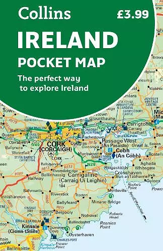
The Ireland Pocket Map is a practical and visually appealing tool for anyone looking to explore the beautiful landscapes of Ireland. This full-color map is designed with convenience in mind, making it easy to carry in your pocket, bag, or glovebox. With its double-sided design, one side features the southern regions of Ireland, including Dublin, while the other covers the northern areas, ensuring comprehensive coverage for travelers.
In addition to its handy size, the Ireland Pocket Map is packed with valuable information. It includes the latest road changes, helping users navigate efficiently. The map also highlights places of interest, making it easier to plan visits to attractions and landmarks. Furthermore, it provides details on ferry routes, speed enforcement zones, and safety camera locations, enhancing the overall travel experience.
With a scale of 1:470,000, or 7.5 miles to 1 inch, this map offers a clear and detailed view of Ireland's roadways and features. Whether you're a first-time visitor or a seasoned traveler, the Ireland Pocket Map is an essential companion for discovering the charm and beauty of this remarkable country.
ISBN: 9780008412821
Dimensions: 140mm x 90mm x 6mm
Weight: 50g
2 pages
New Fifth edition