Rocky Mountain National Park Day Hikes Map
National Geographic Maps author
Format:Sheet map, folded
Publisher:National Geographic Maps
Published:4th Feb '20
Should be back in stock very soon
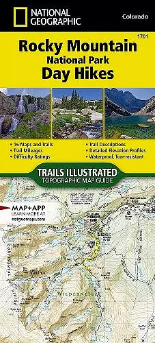
Waterproof, Tear-Resistant, Topographic Map. Thrust skyward by Earth's forces between 40 and 70 million years ago, then sculpted by three glacial episodes, the Rocky Mountains are 'new' in geologic terms, and form one of the world's longest ranges-stretching almost unbroken from Alaska to below the nation's southern border. Rocky Mountain National Park preserves a small but important neighborhood within this range. Just outside the park, the towns of Estes Park and Grand Lake are the primary hubs before entry and are connected by Trail Ridge Road-one of ten America's Byways in Colorado and a national designated All-American Road. The Rocky Mountain National Park Day Hikes Topographic Map Guide includes sixteen diverse hikes for all hiking enthusiasts, from the easy, 4.7 mile long Cub Lake Trail to the strenuous, 8.4 mile long Chasm Lake Trail that brings hikers to base of the 14,259 foot Longs Peak. Each hike has a detailed map, a trail profile visualizing the changes in elevation, an
ISBN: 9781566958004
Dimensions: unknown
Weight: unknown
48 pages
2022nd ed.