Cambrian Way North
Cardiff to Devil's Bridge
Format:Sheet map, folded
Publisher:Harvey Map Services Ltd
Published:11th Apr '25
Should be back in stock very soon
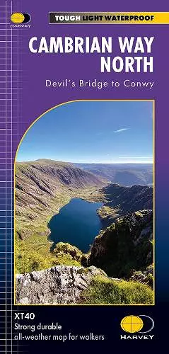
The Cambrian Way is a challenging 479km (298 miles) long distance route along the spine of Wales, from Cardiff in the South to Conwy in the North.
- The entire route across two maps; including sections through Bannau Brycheiniog
- National Park, the Cambrian Mountains and Eryri National Park
- A good week's walking on each map
- Information on accommodation and services
- Lightweight, detailed, clear and easy to read. The route is clearly highlighted in red
- Printed on tough 100% waterproof, tearproof paper
- Full map legend in English and Welsh
ISBN: 9781851376872
Dimensions: unknown
Weight: unknown