Nidderdale Way (2 ed)
Format:Paperback
Publisher:Rucksack Readers
Published:17th Jul '23
Currently unavailable, and unfortunately no date known when it will be back
Nidderdale is perhaps the least known of the famously beautiful Yorkshire Dales in northern England. Uniquely, this scenic valley has three large reservoirs made in the 20th century by damming the River Nidd, creating a haven for birds including rare species. The valley is also rich in human heritage, from mining to Methodism.
The Nidderdale Way is a 54-mile circuit starting and ending in the market town of Pateley Bridge; it can be walked comfortably over four to six days, and is well maintained and waymarked throughout.
Our second edition documents some minor route changes and has improved mapping, with many extra features added and labelled. It is perfect bound, making it lighter and more pocketable than the previous edition.
The book has all you need to plan and enjoy your holiday:
• concise directions, printed on rainproof paper
• 16 pages with detailed route mapping (1:45,000)
• background on the River Nidd, minerals and textiles
• four-page section on habitats and wildlife
• contact details for accommodation and transport
• Link routes from Ripon and Knaresborough
• lavishly illustrated with 95+ colour photos.
The author, retired GP Beth Rimmer, had always believed that Nidderdale lived up to its ancient Celtic name, which means “brilliant.” So … she had found the ideal retirement project. The result, in Rucksack Readers’ new lighter format, maintains the larger (1:40,000) map scale, with more (over 95) beautifully-reproduced pictures and the same amount of always informative and detailed text.
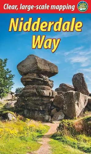
Nidderdale highlights, some just off the main 54-mile waymarked route, include How Stean gorge, Pateley Bridge, Fountains Abbey, Ripon and its cathedral, Ripley and its castle, and Brimham’s spectacular Rocks: see the front cover.
-- Roly Smith * Outdoor Focus, summer 2019, p15 *The route is described clearly and concisely and is easy to follow: small paragraphs ensure that you can keep track of just where you are.
From the publisher’s website you find links to Google maps of the route including link routes, detours and extensions, and a downloadable GPX track.
A wealth of background information on the dale – history, industry, religion, flora and fauna – enhance the walk … this is about as good as a walking guide gets.
-- Susan Wilkinson * Strider 144 (LDWA) *I’ve just walked the Nidderdale Way and really appreciated your book. I can read a map but the extra details were so helpful especially as I walked alone. It was so useful to have guidance that was up to date.
-- Annette C (customer feedback, unsoliciISBN: 9781913817152
Dimensions: 220mm x 130mm x 7mm
Weight: 181g
72 pages
Fully revised