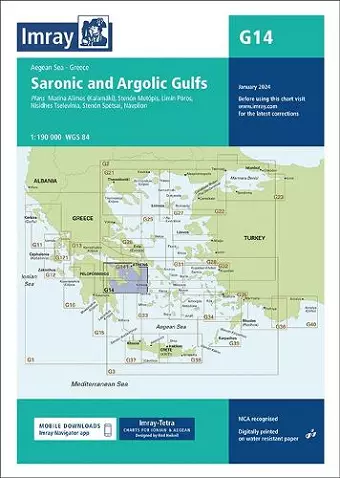
G14 Saronic and Argolic Gulfs
Format:Sheet map, folded
Publisher:Imray, Laurie, Norie & Wilson Ltd
Published:30th Jan '24
Should be back in stock very soon
This edition features updated official data and additional insights from Imray's network, making it perfect for small craft. It includes detailed bathymetric surveys and essential charts for cruising sailors.
"Imray Chart G14" is an essential resource for small craft sailors, featuring the latest official data complemented by additional insights from Imray's extensive network. This edition includes up-to-date bathymetric surveys, ensuring that sailors have access to the most accurate and relevant information for navigating the waters. The charts are meticulously updated throughout, reflecting the ongoing changes in maritime conditions.
Included in this edition are detailed plans for various significant locations, such as Marina Alimos (Kalamáki) at a scale of 1:12,500, Stenón Metópis at 1:30,000, and Limín Póros at 1:25,000, among others. Each chart is designed to provide comprehensive coverage of the Ionian and Aegean seas, making it an invaluable tool for cruising sailors. The charts not only display navigational information but also highlight anchorages, facilities, and inlets that may not be represented on standard official charts.
Imray-Tetra charts have earned a reputation for being the best available for those venturing into these waters. They are created by experienced sailors Rod and Lucinda Heikell, who incorporate first-hand knowledge into their designs. Printed on durable, water-resistant Pretex paper, these charts are built to withstand the rigors of the sea. When used alongside Imray pilot guides, "Imray Chart G14" becomes an indispensable companion for any sailor looking to explore the stunning coastlines and islands of the region.
ISBN: 9781786795489
Dimensions: unknown
Weight: 180g
2 pages
New edition