Mapping the Holy Land
An Illustrated Atlas
Dr Jean-Pierre Isbouts author Dr Neal Asbury author
Format:Hardback
Publisher:Apollo Publishers
Published:16th Mar '26
Currently unavailable, our supplier has not provided us a restock date
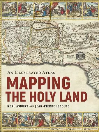
A stunning journey through the Holy Land, as told by the rare maps and prints that have long inspired Jewish, Christian, and Muslim pilgrimages.
From the earliest days of the Roman Empire to the current war between Israel and Hamas, mapping the Holy Land has been a never-ending source of high aspirations and bitter conflict. Sacred to Jews, Christians, and Muslims, the Holy Land has always inspired Christians to walk in the footsteps of the Bible, to imagine the route of the Exodus, or discover the places of Jesus' ministry. Muslims, too, longed to see the geographical contours of the ummah, the greater Muslim community, while Jews remembered the days when Jerusalem was the destination for three holy festivals. In response, cartographers from Late Antiquity to the Modern Age drew their inspiration from Jewish, Christian, and Muslim pilgrimages to depict, with growing confidence, the exotic locations of the Holy Land.
Mapping the Holy Land is the first book to tell the thrilling story of these travels and the incredible prints and maps they spawned, up to the wars of the twentieth and twenty-first centuries. Illustrated with rare, hand-colored maps and engravings throughout and riveting scene-setting history, this remarkable volume from rare maps collector Neal Asbury, CEO of The Legacy Companies and host of Neal Asbury’s Made in America, and National Geographic best-selling author Jean-Pierre Isbouts, coauthors of Mapping America, shows how the faithful overcame impossible odds to reach the Holy Land, and dives deep into the historical understanding of these elusive lands from Roman times up to the modern Israeli-Arab conflict.
Praise for Mapping America
“Antiquarian maps from the 1400s onward reveal historical Western notions of geography and image reproduction, central in the founding of this country.” —New York Times
“A fresh, well-informed addition to the literature devoted to early American history.” —Kirkus Reviews
“The continents reveal themselves slowly in wild and vividly flamboyant illustrations that resonate like the creation of literary fantasy.” —The Bowery Boys
ISBN: 9781954641341
Dimensions: unknown
Weight: unknown
288 pages